Satellite Imagery Solutions
GeoVista Studio offers a robust web-based platform designed to transform how teams interact with spatial data, providing comprehensive solutions for mapping, advanced spatial analysis, and insightful visual reporting. Our platform empowers professionals across various disciplines to leverage the vast potential of geographic information, all within a familiar browser environment.
Unlocking Insights from Above
Our Satellite Imagery Solutions are engineered to bring the world into sharp focus for your projects. With GeoVista Studio, you can effortlessly integrate and analyze high-resolution satellite imagery, gaining critical perspectives on land use, environmental changes, urban development, and infrastructure. This capability allows planners, architects, and sustainability teams to monitor progress, identify areas of concern, and validate project impacts with unprecedented clarity.
- Visualize expansive territories and intricate details from up-to-date satellite feeds.
- Track dynamic changes over time, from deforestation patterns to urban sprawl.
- Assess environmental conditions and support conservation initiatives with accurate, timely data.
- Enhance site selection and feasibility studies with a bird's-eye view of potential locations.
Seamless Integration and Analysis
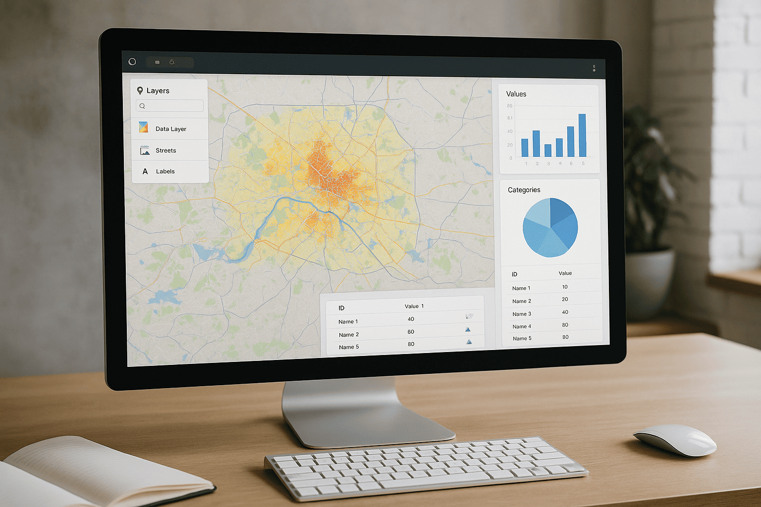
GeoVista Studio facilitates the powerful combination of diverse geographic layers, including your proprietary data and satellite imagery. This integration capability allows for sophisticated spatial analysis, enabling teams to derive meaningful metrics and uncover hidden patterns that drive informed decision-making. The platform supports modern cartographic processes, ensuring your analytical work is precise and impactful.
Compatibility with industry-standard tools, including ArcGIS, means your existing workflows can be seamlessly integrated. This allows for a smooth transition and enhanced collaboration, as all team members can access and contribute to a unified spatial understanding. Present analytical data about terrain and work collaboratively in a shared digital space.
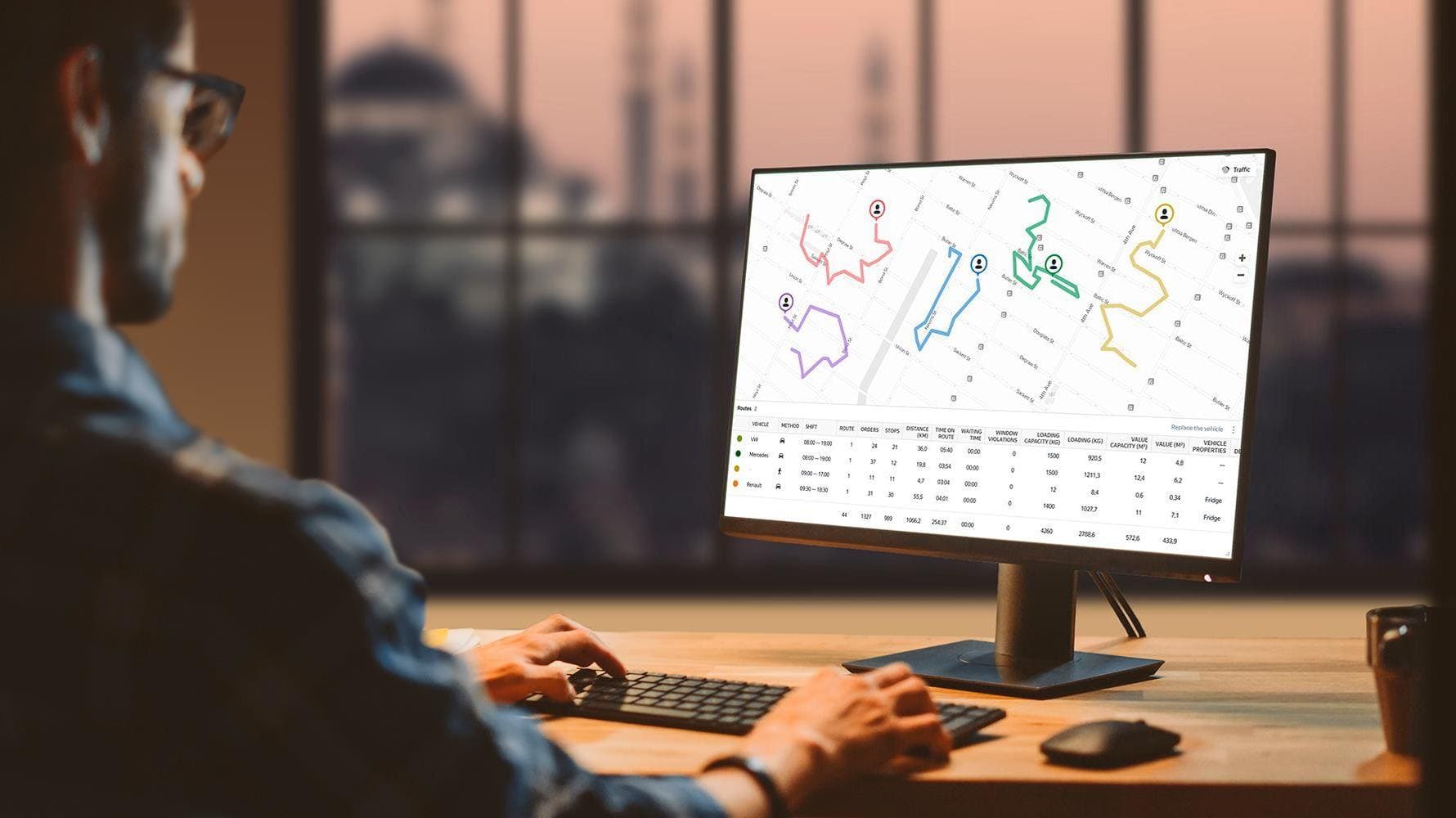
Collaborative Mapping for Impact
Collaboration is at the heart of effective spatial planning. GeoVista Studio enables teams to share interactive maps and analytical reports directly online. There's no need for complex software installations or downloads; every feature is accessible through your web browser. This streamlined approach fosters efficient teamwork and ensures that all stakeholders have access to the most current and relevant spatial intelligence.
Empower your team to combine geographic layers, analyze key indicators, and distribute dynamic maps with ease. This browser-native experience ensures that your focus remains on the analysis and insights, not on technical hurdles.

Satellite Imagery Solutions
GeoVista Studio offers a robust web-based platform designed to transform how...

Urban & Regional Visualization
GeoVista Studio offers a sophisticated web platform engineered to transform how...


GIS System Implementation
In today's dynamic environment, leveraging geographic data is paramount for...